The Mountain Pass Before the Scenic Road
A mountain pass history reveals how a practical crossing became travel imagery, helping you read old route traces and understand what a scenic road replaced.
What did a mountain pass mean before a scenic road made it a destination? Mountain pass history begins with a practical question: where can people, animals, and goods get across a high barrier without taking an even harder way around? The answer might be a saddle, a notch between peaks, or a broad shoulder that looks unremarkable from below. Its importance came from movement, not a view.
Imagine a clearly hypothetical valley called Alder Vale, divided from its neighbor by a steep mountain wall. A narrow pass called Slate Notch is the least difficult crossing. At first, travelers use a footpath there. Much later, a road reaches the notch, and guidebooks begin presenting the journey as an outing. Walking through that invented change shows how the same place can serve as passage, infrastructure, and image without losing its older traces.
A pass starts as a choice among difficult routes
A mountain pass is a route through high ground, often at a lower point along a ridge. “Lower” is relative: the crossing can still be cold, exposed, and demanding. Its value lies in comparison. A route over the pass may be less arduous than climbing a neighboring summit or detouring around the range, even if it offers no easy travel in an absolute sense.
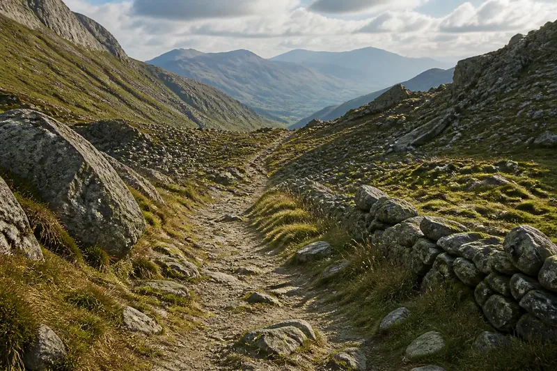
In the imagined Alder Vale, people moving between settlements might choose Slate Notch because its approach slopes are gentler than the cliffs elsewhere. That choice does not require a formal road or a single founder. Repeated journeys can make a faint track legible: packed earth, a worn gap through brush, or stones shifted from the line of travel. Such signs suggest use, though they do not by themselves tell us who traveled, how often, or for what purpose.
The route’s value would also depend on what travelers needed to carry and the conditions they faced. A person on foot can use a narrower path than a loaded animal. Snow, loose rock, swollen streams, and poor visibility can change which crossing seems preferable. The pass is therefore not merely a feature on a map. It is a negotiated path through terrain, chosen in relation to bodies, burdens, seasons, and destinations.
Repeated passage leaves a human-scale record
Suppose the Slate Notch path becomes a regular link between Alder Vale and its neighbor. In this invented situation, local travelers keep to a firm strip of ground rather than cutting a fresh track each time. They may clear branches, step around a boggy patch, or use a stable shelf above a stream. The observable result is a route shaped by many small decisions rather than one grand construction project.
At a steep section, a path might zigzag instead of climbing straight uphill. Near a stream, it could approach a dependable crossing point. A sheltered hollow might serve as a pause in bad weather, while a bare crest remains only a place to cross. These details can make an old route feel intimate: it follows the scale of a traveler’s next foothold, not the sweep of a distant panorama.
Local knowledge matters, but it should not be romanticized as a single, timeless tradition. Routes change when a bridge fails, a slope becomes unstable, a settlement shifts, or another crossing proves more useful. In the Alder Vale story, a washed-out approach could lead people to a neighboring saddle for a while. When the original path becomes passable again, some travelers might return and others might not. A familiar line on the ground can record adaptation as much as continuity.
For readers examining a real pass, physical traces are clues, not a complete account. An old track, a retaining wall, or a worn stone surface can point to human movement, while local records, maps, and oral histories may clarify who used it and why. If evidence is missing, it is better to leave the question open than to turn an appealing guess into a settled story.
Why did the pass matter before the road?
Was every mountain pass an ancient trade route?
No. A pass may connect nearby grazing land, settlements, or seasonal work without serving long-distance commerce. The route’s use has to be considered in its local setting rather than inferred from its dramatic position.
Why did travelers choose a difficult crossing?
A pass can be the least demanding available option, not an easy one. Its approaches, water access, shelter, and seasonal conditions all shape whether the crossing makes sense.
Can a trail reveal who used it?
A trail’s form can suggest how people moved through the ground, but it rarely identifies travelers on its own. Pair visible features with independent local evidence before assigning a group, purpose, or period.
What changed when a road arrived?
A road could carry different loads, serve different vehicles, and connect the pass to a broader transport network. It also altered what travelers noticed: the route could become a view to seek, as well as a way to get through.
Road building changes the scale of the crossing
In the hypothetical Alder Vale, a new road eventually reaches Slate Notch. The work might require a wider corridor, engineered drainage, a bridge, or cuts into a slope. Unlike a footpath that bends around obstacles, a road must suit its intended traffic and keep a usable surface. That makes the crossing more visible and can reshape the land well beyond the crest.
The new road does not simply replace the old path in a neat, final moment. The foot route might remain beside it, disappear beneath construction, or still be used for local journeys. The road may bypass the old stopping place or draw activity toward a new one. A pass can accumulate layers of access: a path for walking, a road for wheeled travel, and perhaps later a viewpoint or a marked stop.
Roads also change the meaning of distance. A crossing that once required local knowledge and careful timing may become part of a longer trip planned around vehicle travel. This does not erase the effort of crossing high ground, but it shifts which effort is most noticeable. Travelers may focus on bends, grades, weather delays, and the sequence of views from a window rather than the placement of each footstep.
For a hypothetical visitor reaching Slate Notch by car, a pullout could make the crest a place to pause and look outward. The road’s curve might frame a valley, while a sign names the crossing and marks it as a destination. The expected observable result of that change is a new public image of the pass: not only a route between places, but a scene that travelers are encouraged to notice, remember, and photograph.
Scenic travel recasts passage as an experience
Travel imagery often presents a pass as a threshold: leave one landscape behind, arrive in another, and pause at the high point between them. This is a compelling way to see the journey, but it can conceal the practical work that made the route possible. A dramatic viewpoint may depend on road cuts, drainage channels, barriers, and maintenance crews that rarely appear in the frame.
In the Alder Vale example, imagine a brochure showing Slate Notch under clear skies, with the road curling toward the crest. The picture could make the crossing seem like a natural stage set, ready for visitors. Yet the image has a selective edge, like a picture frame: it focuses attention while leaving the approaches, old footpath, and working landscape outside its borders.
Scenic meaning does not make a pass less real or less useful. A place can carry several roles at once. Residents may still cross for practical reasons, while visitors pause for the view. Road workers may regard the same stretch as a maintenance responsibility, and a historian may read it as evidence of changing access. The different interpretations coexist, though they do not necessarily give equal weight to the people who use the route daily.
That tension is worth noticing when reading travel posters, photographs, guidebook descriptions, and roadside signs. Ask what the image includes and what it leaves out. Does it show a road as a line through open wilderness, or acknowledge the work and infrastructure that sustain access? Does it present the pass as a place to arrive, or as a route connecting communities on both sides?
How can you read an old pass on the ground?
A useful visit does not require treating every stone as proof. Start with the landscape and ask what kinds of movement its shape permits. Then look for evidence at more than one scale: the broad connection between valleys, the route’s approach, and small traces near the crossing.
- Compare the pass with nearby alternatives. Notice whether its saddle or notch offers a gentler line through the ridge, while remembering that present-day appearance may differ from past conditions.
- Look for changes in route width and surface. A narrow footpath, a broader graded track, and a paved road serve different kinds of travel, though later work can obscure earlier alignments.
- Notice how the route handles water and steep ground. Drains, bridges, cut slopes, and switchbacks reveal practical responses to terrain, but their age and purpose may need local documentation.
- Find what the viewpoint leaves outside the frame. From a pullout, look back toward the approach and across the crest to see whether the celebrated view masks a working corridor.
- Check signs and maps against visible traces. Names can preserve a route’s public identity even after its use changes; compare them with older maps or local interpretive material where available.
- Keep observation separate from attribution. Describe what you see first, then seek reliable context before naming a builder, traveler, or historical purpose.
In the invented Alder Vale situation, a visitor who notices a narrow path beside the newer road might reasonably ask whether it is the old crossing. That is a useful question, not an answer. The visitor could compare its direction with the road, inspect whether it leads toward the notch, and consult local historical material. The expected result is a more careful account: the path appears to connect the valleys, while its precise age and users remain unconfirmed unless further evidence supports them.
A pass keeps its history in the layers of travel
The story of Slate Notch is invented, but its sequence offers a way to think about real crossings without reducing them to scenic overlooks or ancient mysteries. A pass begins with relative advantage: a way through difficult ground that makes sense beside other routes. Repeated movement can leave a human-scale path. Road construction can widen access and alter the crossing’s form. Travel imagery can then turn the route itself into part of the attraction.
Those roles need not arrive in a clean progression or cancel one another. A pass may remain a working connection while also serving as a viewpoint, and an older trail may survive beside newer infrastructure. Mountain pass history is easiest to read when the landscape is treated as a record with layers, not a stage frozen at the moment a photograph was taken.
When you next pause at a mountain crossing, look beyond the crest toward both approaches. The road’s direction, the path’s scale, the place where water runs, and the view chosen for the stopping point can each reveal a different decision about movement. That small shift in attention restores the pass’s most useful story: before it became scenery, it was a way through.